Hello!
I’m so glad you’re here. I hope you enjoy reading about about my experiences moving from Michigan to Alberta to Arizona & now Missouri!

I’m so glad you’re here. I hope you enjoy reading about about my experiences moving from Michigan to Alberta to Arizona & now Missouri!
Length: 5.3 miles (if you do the full loop)
Elevation Gain: 1,830 ft
Date Hiked: August 27, 2020
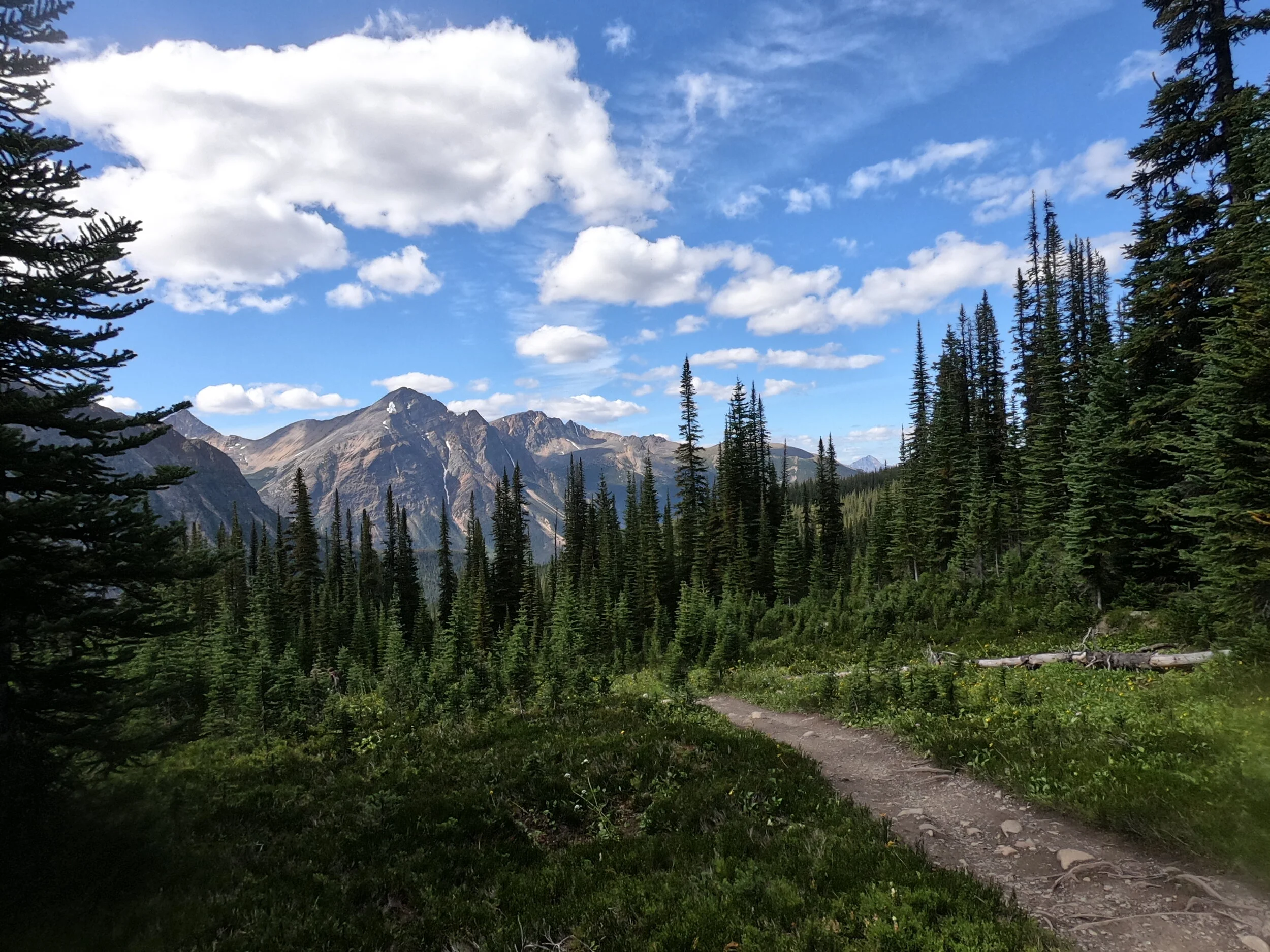
This hike was absolutely gorgeous and one you should definitely add to your Jasper bucket list! Getting there (from Banff), you'll take Highway 93 to the 93A junction. This junction is actually where Athabasca Falls is, so if you have time, and it's not too busy, be sure to stop here first! You'll follow 93A through some beautiful woods and water making you feel like you're in the middle of nowhere.
Shortly after passing Wabasso Campground, you'll come to Mt. Edith Cavell Rd on the left. If you have a camper, leave it at the parking lot right there, because you will quickly learn that long vehicles can't make the turns on this road. It is a very tight and windy drive back to the trailhead, so take it SLOW and be aware of bikers and wildlife!
You'll dead end at the parking lot, complete with bathrooms after that long drive. It can be a little confusing finding the trailhead, as there are other paths that take you closer to the glacier. Make sure you stay to the left and follow the paved trail to start. Don't cross the creek unless it's over a man-made bridge on that paved trail. You'll be surrounded by people in all sorts of clothing and footwear because most people are just venturing the short distance to the glacier/pond overlook. We decided to skip this area because of COVID and honestly, you can get pretty amazing views of it further up.

Before you get to the overlook, you'll have the option to go left up switch backs—this is the route to the meadows. A note for other dog people out there, this hike is NOT dog friendly. I didn't realize this until we were there, but we didn't have the dogs on this trip so we didn't have any issues. Look out for little marmots who roam this area, and be sure to give them space to keep living their mountain lives.

After venturing up the switchbacks, you'll approach a marked fork in the trail. You can choose your own adventure here, as both trails will meet back again further up. The left is the shorter, a bit steeper option which is the route we took. You'll make your way through the gorgeous meadows, and the flowers really pop next to the green grass. It was so dreamy—especially on a bluebird day! We did read (the day after our hike) that a mama bear and her cub had come through there earlier that day, so this is a reminder that YOU ARE IN BEAR COUNTRY. No matter how busy the trail is, have your bear spray in reach and know how to use it!

Once you're through the meadows, the terrain turns to loose/scree-like rock. You'll continue straight up until you reach the point where the other trail (from the loop) meets. There will be a sign at this meeting point, but the fun is not over! The path veers to the left a bit and then will cut back to the right up to the viewpoint. I'd have your poles with you on this hike because it can get very loose and dry through here in the summertime.
If you're up for an even bigger challenge, you can continue up to the summit, but we had just done Wilcox Pass and thought this point was a great place to stop. You have a fantastic view of Mt. Edith Cavell and the glacier, as well as mountain views all around you. Take some time to sit and enjoy a snack. There's plenty of room for people to roam and sit in this area.

You'll descend the way you came up and once you reach the sign/fork in the trail, you can decide if you want to take the longer loop to the left or go straight down. For the sake of time, hunger and tiredness, we decided to head down the way we came up. Be aware that the meadows can get wet and muddy (much different than above the treeline), so watch your step and take it easy on the descent. Overall, this is a great moderate hike with stunning views the entire way up!
