Hello!
I’m so glad you’re here. I hope you enjoy reading about about my experiences moving from Michigan to Alberta to Arizona & now Missouri!

I’m so glad you’re here. I hope you enjoy reading about about my experiences moving from Michigan to Alberta to Arizona & now Missouri!

Length: 6.1 miles (9.8 km)
Elevation Gain: 4,150 ft (1,264 m)
Date Hiked: August 8, 2020
Disclaimer: Only the first (about) two miles of this trail is a hike. After that, you're either venturing over to the hot springs or ascending very loose rock that eventually becomes a steep scramble. If you plan to summit Mist Mountain, come prepared with the proper gear: sturdy boots, poles, a helmet, a shell (jacket) to block the wind, and plenty of water.
Finding the trailhead can be a bit tricky. Although this is a pretty popular hike—because of the hot springs—the cars on the road will be a good indicator you've found it. A lot of people park along the road, but there is a paved parking area that I recommend you use so your car is further from traffic. There is a tall pole in the ground at the trailhead that—when we went—had a red flag on it. Again, it's a pretty popular hike, so you should be able to see the path.
Your hike will begin in the trees with a slight incline, but it quickly becomes steep. It's totally worth it once it opens up and you're surrounded by pine trees and rolling green hills that look like you could be in Ireland. Make sure you're making your presence known through here. It felt a little eerie because there were no other people on the trail with us. This park of K-Country is a very popular area for grizzlies, so stay alert and have that bear spray ready to go.

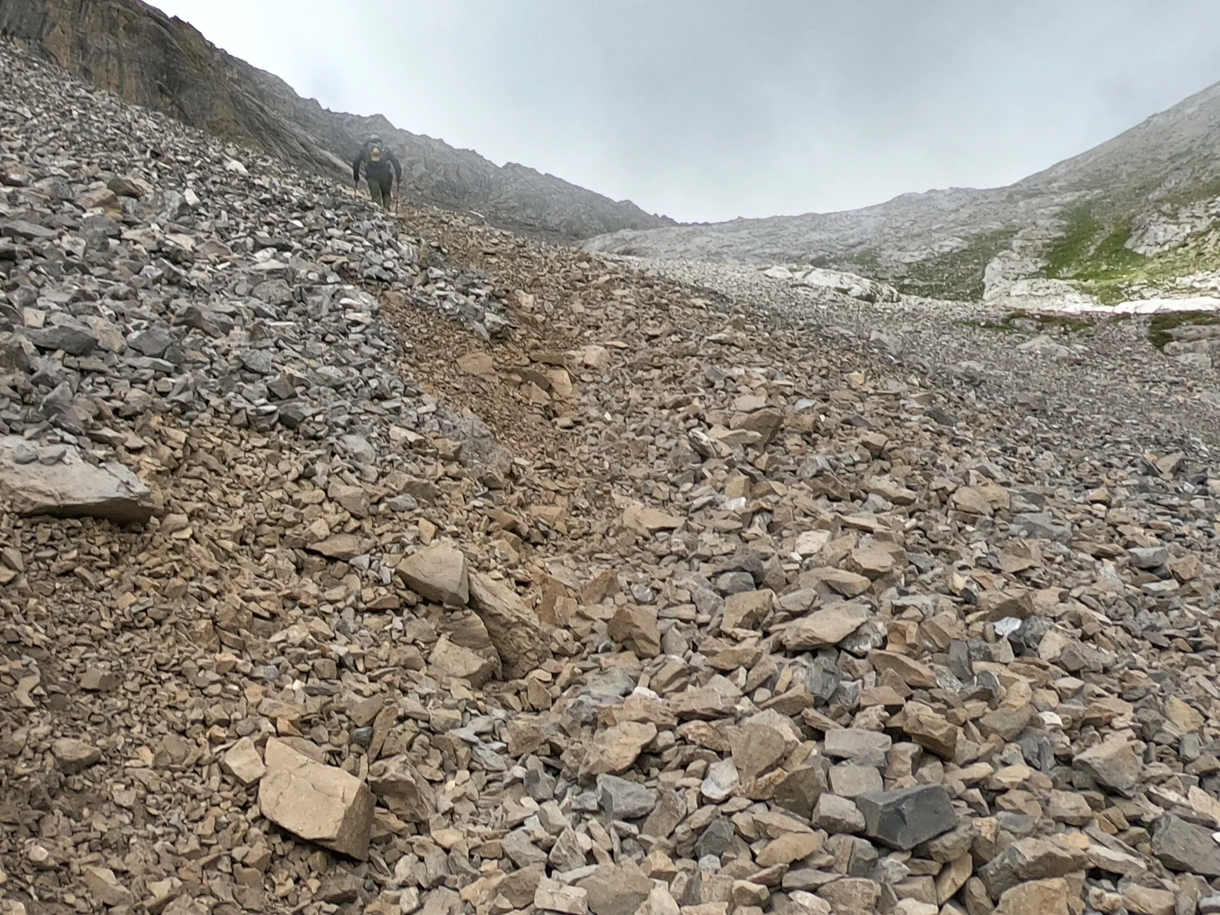
You'll continue to make your way up and through the hills until you reach a ridge. Most people with children will turn around at this point because the trail turns to loose rock. We got a little confused here because it looks like there are a few different trails, and the All Trails map isn't totally clear. If you're planning to summit, you want to follow the trail over the rocks rather than up the green ridge. Be very careful walking through here. It's also the trail to the hot springs, so it can be heavily trafficked. When you reach the fork in the path, stay to the left and begin another ascend. You'll likely have to cross a small snow patch that can get very slick as the sun comes out. You don't need spikes but your poles will be very helpful.


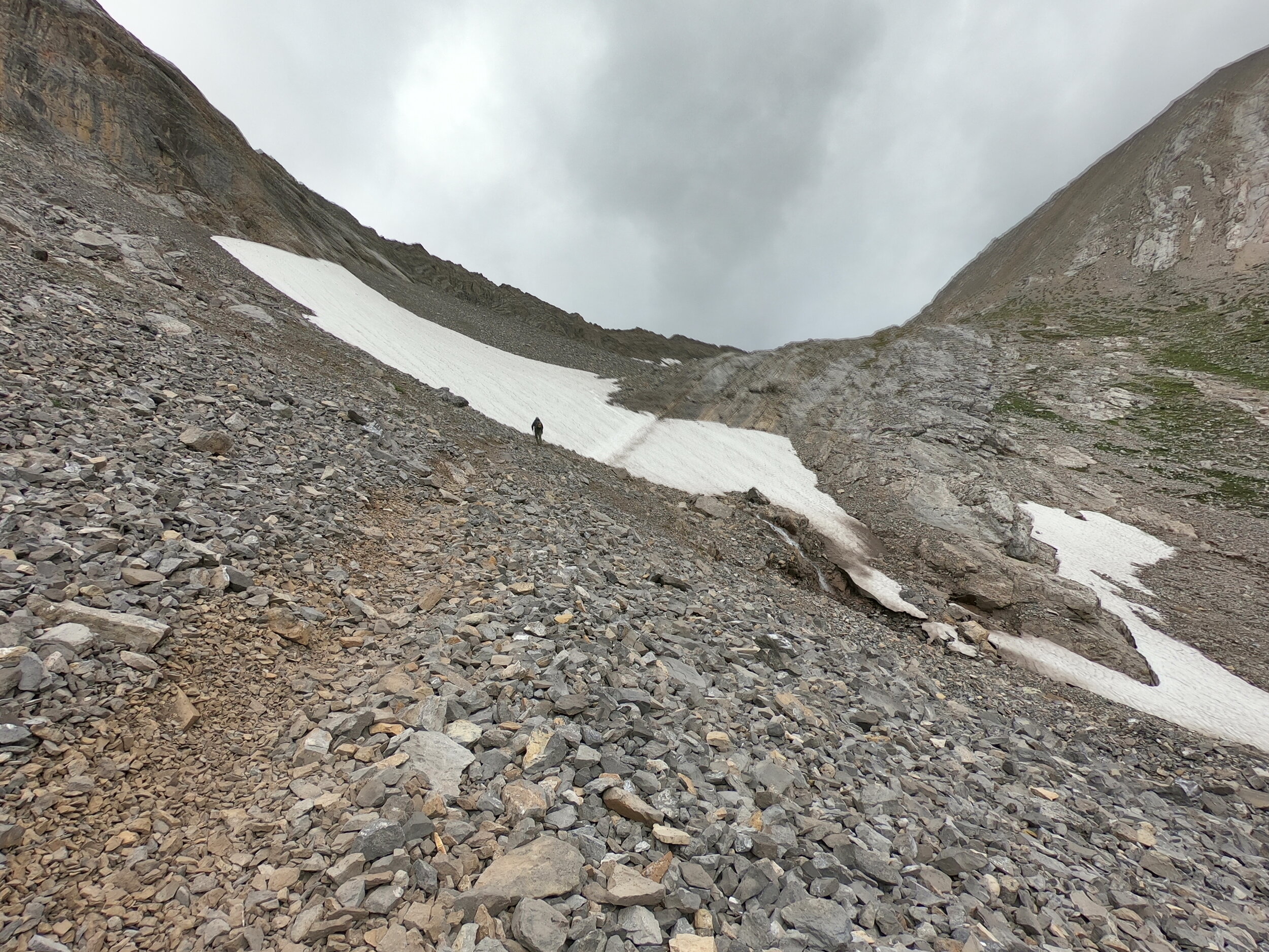
The next leg of the trek is over medium to large-sized boulders that might move when you step on them. Take your time going through here as you could easily fall or get your ankle twisted. At about 2.5 miles in, you'll be at the col and have a choice to go right up to a ridge (the alternate route) or continue forward—the more direct route and the way we chose to go. You must stay to the right of the cliff-like rock on the ridge on your left. When we ascended, there was a large patch of snow to the summit, so we just stayed to the right of that.
Here comes the fun! The rock is extremely loose through here and it will likely take you an hour (maybe more) to climb what seems like not that far of a climb. Be prepared to take a step and slide down, because the rocks are so small that it's hard to get a good grip. What worked for me was utilizing my poles and upper body strength to lock in and pull myself up. Be aware of others climbing ahead of you, because there are bigger rocks that will fall—hence why I wore a helmet. Once you reach what feels like the top, you'll climb up just a short bit of rock to the right. You'll know you've reached the summit when you see the plaque of a fallen hiker.


It's definitely a humbling moment to stand up there in the clouds—seeing mountains for miles. It was a sunny day for us, but clouds kept rolling through so we snapped our pictures and began to make our way down. It was crazy windy and I was exhausted, but it was so worth it.

As you descend, take a moment to look around at the view. It's seriously unreal. Also, make sure your path down is around those climbing up. You shouldn't have any issues making your way out. Stay up and out of the lower part of the col, because you'll need to climb back up the small rock slab (on your left) to make your way back to the snow path. From there, the trail is well-trafficked and easy to follow.

If you plan to do the hot springs, get there VERY early!! We decided to skip it because it was too busy, and I preferred to get back and binge eat pizza than sit in a warm pool of water that others have been sitting in. But that's just me.
This is a really great scramble if you're looking for a challenge and a solid prep for higher climbs. We really enjoyed this experience and were happy to have all the proper gear we needed to be safe every step of the way.